Indoor Mapping & Navigation
CAD to routable indoor maps and interactive 3D buildings.
What it is
Large buildings such as hospitals, malls, airports and campuses are hard to navigate. We convert architectural CAD into clean, routable indoor map data and interactive 3D building models that power wayfinding apps, kiosks and facility tools.
You receive
- IMDF / GeoJSON
- Routable indoor network
- Interactive 3D building
- Points of interest database
Typical uses
- Hospitals and healthcare campuses
- Malls and airports
- University and corporate campuses
- Facility and asset management
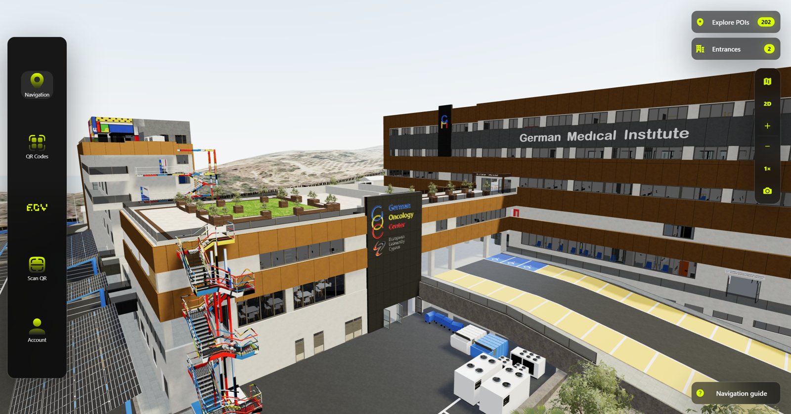
German Medical Institute, Cyprus: from CAD drawings to live 3D navigation.
The German Medical Institute (GMI) needed patients and staff to find their way across seven floors and two entrances. We converted the architectural CAD into routable indoor map data and built an interactive 3D model of the building for the hospital's live navigation.
- 01Data conversion — CAD floor plans to clean, georeferenced indoor map layers: rooms, doors, corridors, lifts.
- 02Routing network — multi-level paths across lifts and stairs, with accessible routes.
- 03Interactive building — 3D model with 202 searchable points of interest.
- Floors
- 7
- Points of interest
- 202
- Entrances
- 2
Explore the live 3D model
From scope to delivery.
We agree the site boundary, the accuracy you need, the coordinate system and the deliverable formats, then send a clear quote.
Indoor Mapping & Navigation: common questions.
What do you need from us to start?
The architectural CAD (DWG) floor plans for each level, plus a list of departments or points of interest. We take it from there.
Can routes avoid stairs?
Yes. The routing network can include accessible-only paths that use lifts and ramps.
Do you have a live example?
Yes. Our work for the German Medical Institute in Cyprus is live: seven floors, two entrances and 202 points of interest.
Need indoor mapping & navigation?
Send us the location and what you need. We reply within one business day.